Altitude 2459 m/s.l.m.
Municipality Pelugo
Mountain group
Adamello Presanella
Location
Bus del Gat
History and environment
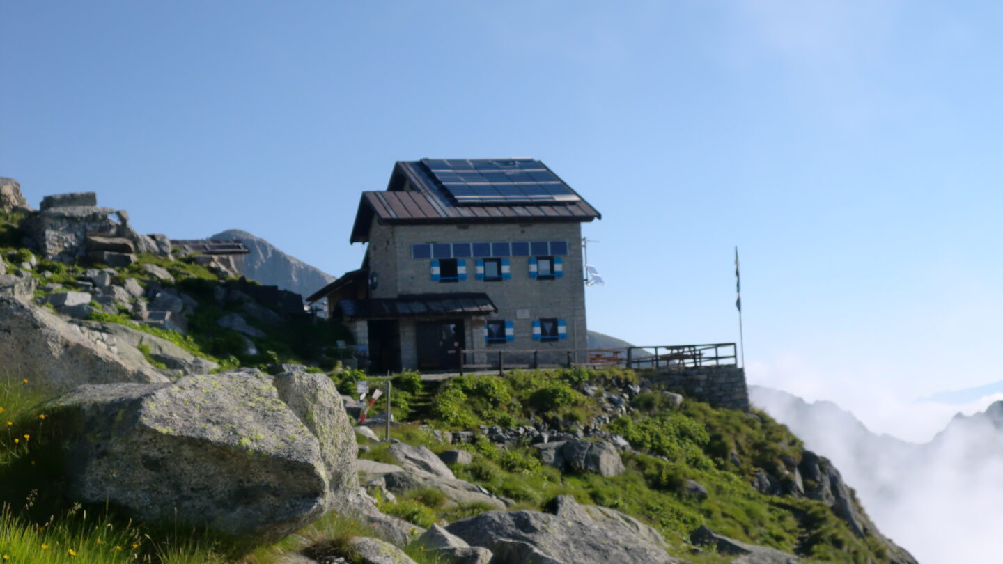
Where at the time of the Great War there was a real military village at high altitude, completed with cableways (five) and an autonomous power plant, today stands the Carè Alto hut, built in 1912 by a company of friends from Rende called SARCA, as the river that flows in Val Rendena, and acronym of “Società Alpinisti Rifugio Carè Alto”. It was later sold to the S.A.T. It resisted with the original cube structure until the end of the 1980s, when it was expanded and modernized. The new Carè Alto refuge was inaugurated in the summer of 1988. The building is located on the great eastern ridge that descends from the top of Carè Alto dividing the valleys of Conca and Niscli, and the respective glaciers in the upper part of the Val di Borzago. Its dominant position and altitude make it a panoramic point of great interest, with a splendid view to the east towards the Brenta Dolomites. The whole surrounding area is extremely wild; it has been preserved thanks to the difficulty of access both from Borzago and from other directions. The surroundings of the refuge are still today an open-air museum of the great war, with walkways, trenches and remains. In the immediate vicinity of the building, the characteristic passage known as the “Bus del Gat” initiates the mountaineer on the ascent to the Làres and Niscli glaciers, while a little above, on the Cerana ridge, there is still a cannon from the First World War; it can be reached in about 1 hour on foot from the refuge. Near the refuge there is a further testimony of the great war: it is the small church, built with wooden logs by Russian prisoners.
Guides and maps
Recommended guides and maps: Mountaineering guide: SACCHI, Pericle, Adamello: volume I, Milan, CAI, TCI, 1984 (Italian Mountain Guide) Hiking guide: TORCHIO, Fabrizio – GARDUMI, Enzo, Excursions in the Adamello Brenta Park, Trento, Panorama, 1995 Cartography: – KOMPASS map in scale 1:25.000 n. 638 “Adamello”.
Access
- from Borzago m. 640, along the 7 km road in the Val di Borzago up to Pian della Sega m. 1250, then path 213 which from Malga Còel di Pelugo m. 1423 crosses Rio Bedù over a bridge. From Pian della Sega – 3.30 hrs;
- from Borzago – 6 hrs.

Follow us on our social channels and use the hashtag #guidealpinevaldisole