Altitude 1990 m/s.l.m.
Municipality Cles
Mountain group
Dolomiti
Location
Dolomiti di Brenta - Monte Pèller
History and environment
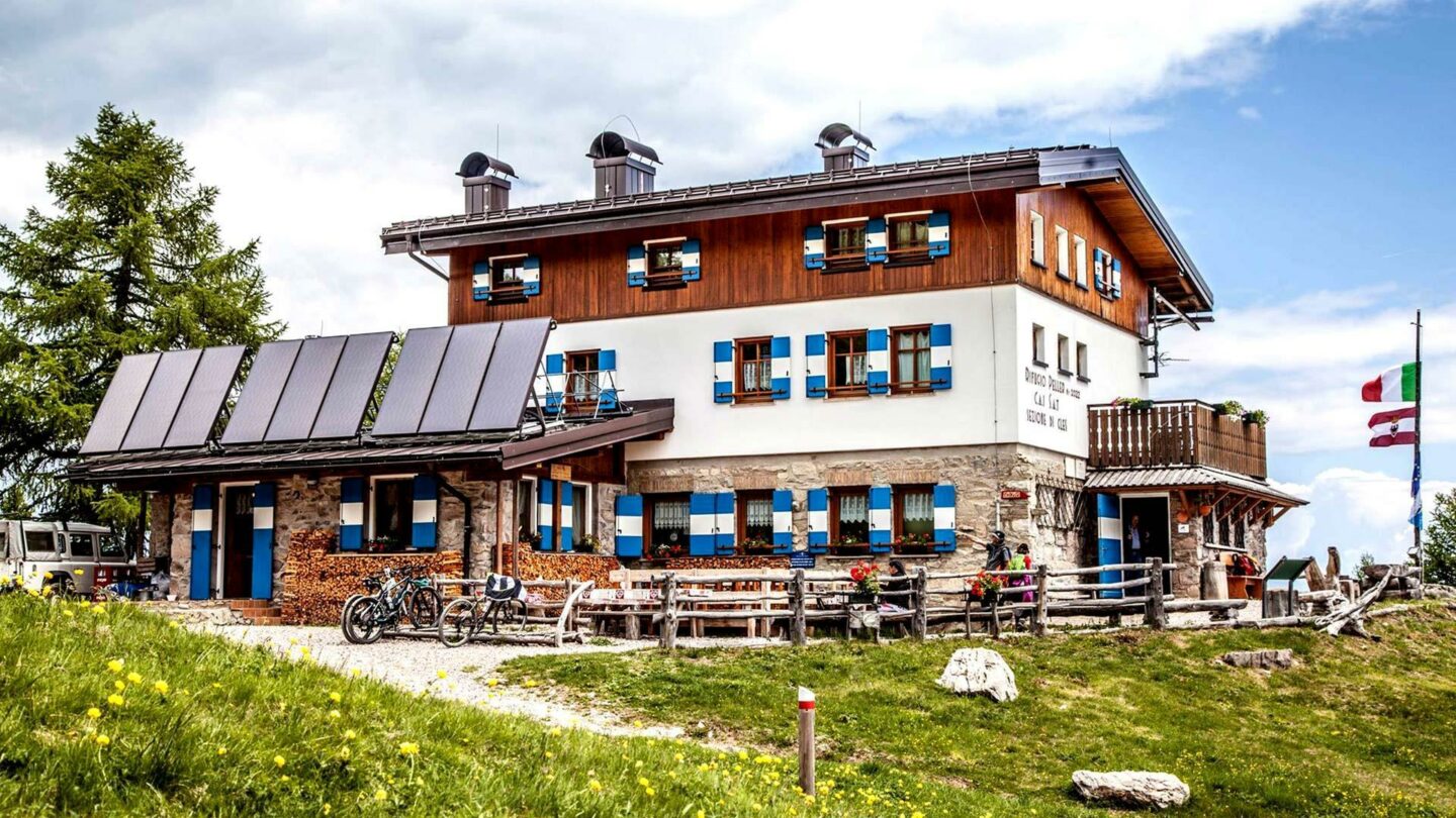
The first Péller hut was built in 1903, on the initiative of some members of the S.A.T. of Cles, at the Malga Clésera and was sold to the S.A.T. in 1914. In 1925 the S.A.T. created the Sentiero delle Palete which crosses the entire northern range of the Brenta Dolomites and connects the Péller and Stoppani refuges to the Grostè Pass. In 1942 the refuge was dedicated to Paolo Lorenzoni, but the following year a fire destroyed it completely. Only in the summer of 1950 did the reconstruction work by the S.A.T. of Cles. In February 1962, another furious fire destroyed the shelter again. The Cles Section soon got back to work to revive the refuge which was inaugurated in 1965 in the locality of Malgaròi on the north-eastern slope of the Péller. Connected to Cles by a dirt road, the Péller hut, even if a little far from the main peaks of the northern Brenta chain, remains a good base for traversing the entire mountain group: from Péller to Grostè; a route that trained hikers cover in a whole day, but which can be broken up as this itinerary is well served by two bivouacs, the Costanzi at Pra Castrón and the Bonvecchio bivouac at Cima Sassara. Equally interesting are the itineraries towards the Tóvel area, through the Val Formiga, the alpine pastures and pastures above the Val di Tóvel and S. Maria Flavona. Going up from Malè, just above Malga Cles, you come across the small church dedicated to the Madonna della Neve. During periods of closure, hikers can use another support point that is always open, the Pinamonti bivouac 2090 m., created by the S.A.T. di Rallo in the nearby Tassullo malga in the Minèrf area. The territory on which the refuge is located falls within the range of the Trentino brown bear. In 1990 the S.A.T. has published its own document containing a series of proposals for the concrete protection of the last bear specimens in Trentino. In addition to canceling some paths that crossed areas habitually frequented by bears from its register, the S.A.T. asks mountaineers and all visitors to the northern Brenta Dolomites “particular attention and respect when traveling the itineraries of the area on foot or on skis or mountain bikes, in causing unnecessary disturbances, avoiding leaving the marked routes”.
Guides and maps
Mountaineering guide: BUSCAINI, Gino – CASTIGLIONI, Ettore, Brenta Dolomites, Milan, CAI, TCI, 1977 (Italian Mountain Guide) Hiking guide: GARDUMI, Enzo – TORCHIO, Fabrizio, Guide to the Brenta Dolomites, Trento, Panorama , 1987-1990, 3 volumes. Cartography: – Brentagruppe = Gruppo di Brenta, 4. ed., München, Deutschen Alpenverein, 1996, Scale 1:25.000 (Alpenvereinskarte; 51) – KOMPASS map in scale 1:25.000 n. 688 “Brenta group”.
Access
- from Cles m. 658 on a 17 km road, trail 313 – 4 hours.
- from Malè m. 738 trail 308 which passes by the Mezòl refuge m. 1485, along the forest road, to Malga Cles m. 1889 (and signpost 313) – 3.30 hrs.

Follow us on our social channels and use the hashtag #guidealpinevaldisole